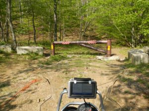
DNR gate at the end of Comb's Road
This should come as no shock, but I thought it was interesting and worth sharing.
Just be careful as you plan trips around Brown Co. The roads on your GPS, DeLorme Atlas and Google maps may not be open.
The photo above was taken on Comb’s Road just outside of Elkinsville.
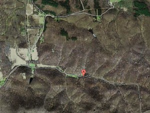
This is what you currently see on Google Maps. Point ‘A’ is the location of the gate and it appears the road goes on through.
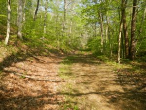
It’s been closed due to lack of county maintenance funds. I spoke with some locals who were very nice and told me the gate opens with a key making it accessible for handicapped hunters through the DNR. But lose the notion of going around with your bike. If they catch you on it otherwise you’re going to be in trouble. And according to the guy I spoke with he wouldn’t attempt it on his trials bike! Before the roads were closed, they were throughly trashed by 4×4’s and then erosion has taken a toll, as well.
The lack of maintenance funds has also meant some roads reverting from pavement to gravel–which is a good thing for GS purposes!
The gravel roads that I found were uniformly in excellent condition, otherwise. But many of them ended in similar barricaded dead ends. DeLorme/Garmin/Google/NavTeq have a lot of updating to do!
Funny aside, just to get the first photo I went a ways down a pretty normal gravel road. Then the gravel got a little thinner. Then there was an old trailer parked in a meadow. Then it turned into what looked like somebody’s driveway, but no posted signs for end or road or private property, etc at any point. Then there’s a horse just standing and grazing, unfenced in this driveway. A small stream crossing and the road changes to a little more trail-like covered in horse droppings going along side a fenced pasture. Then the gate pictured above pops up! There was a small turn-around/parking area there. Maybe for hikers/mountain bikers?
-Dallas Peak


You must be logged in to post a comment.